inTegRated mAnagemeNt modelS For archaEological paRks
Sibenik City Museum – Croatia

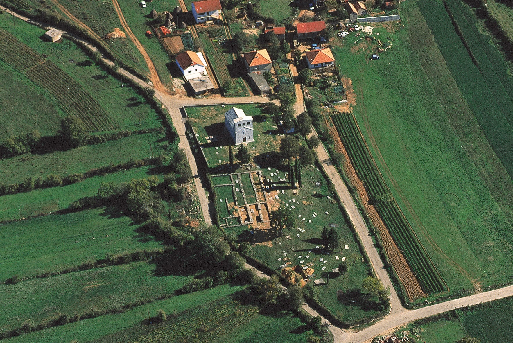
Name of archaeological site: CRKVINA (Biskupija)
Type of archaeological site: church
Location: near by City of Knin
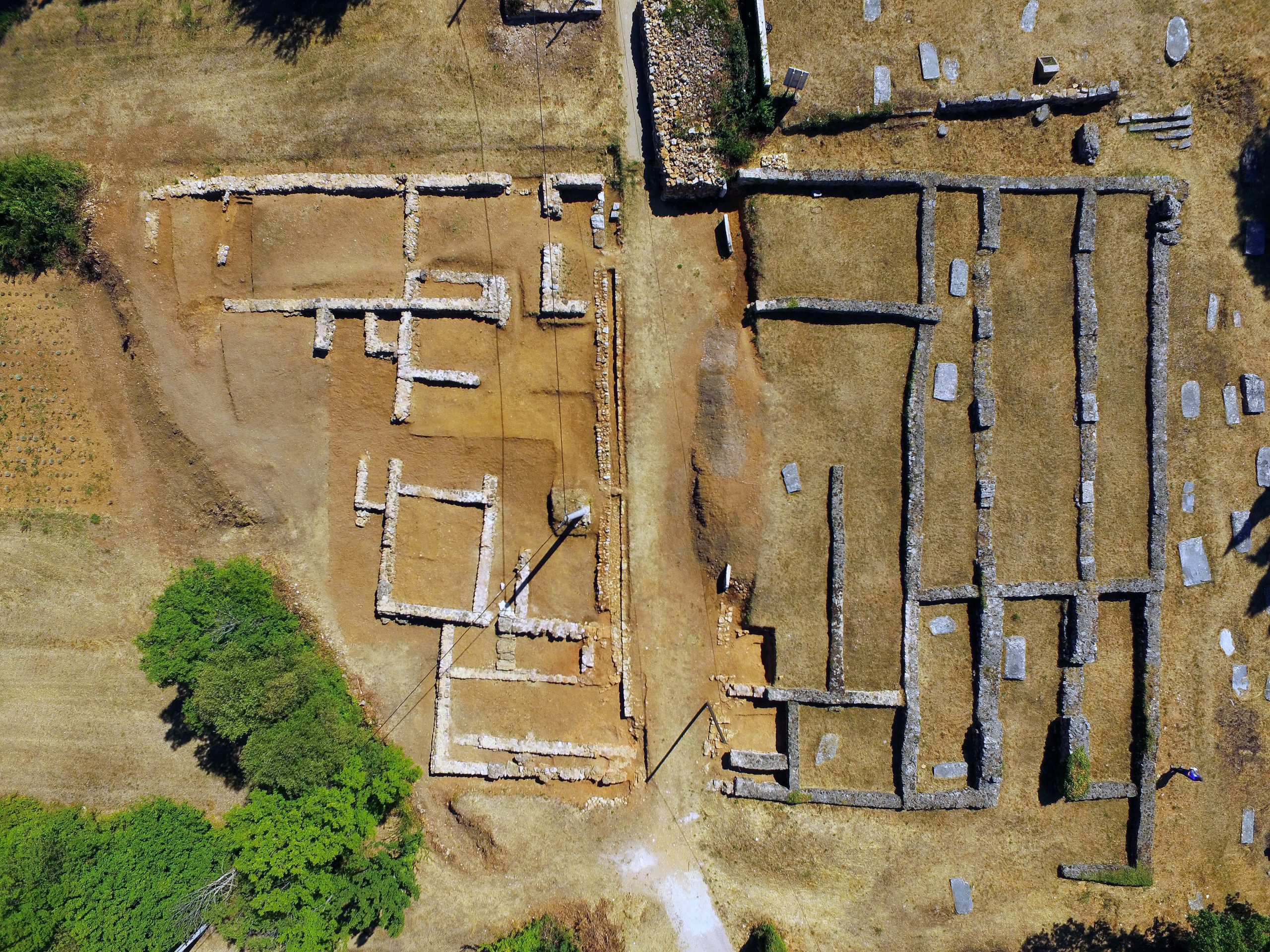
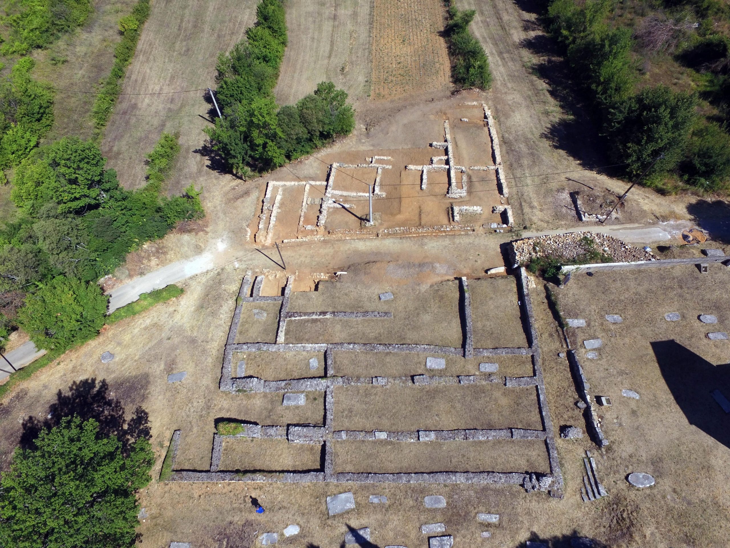
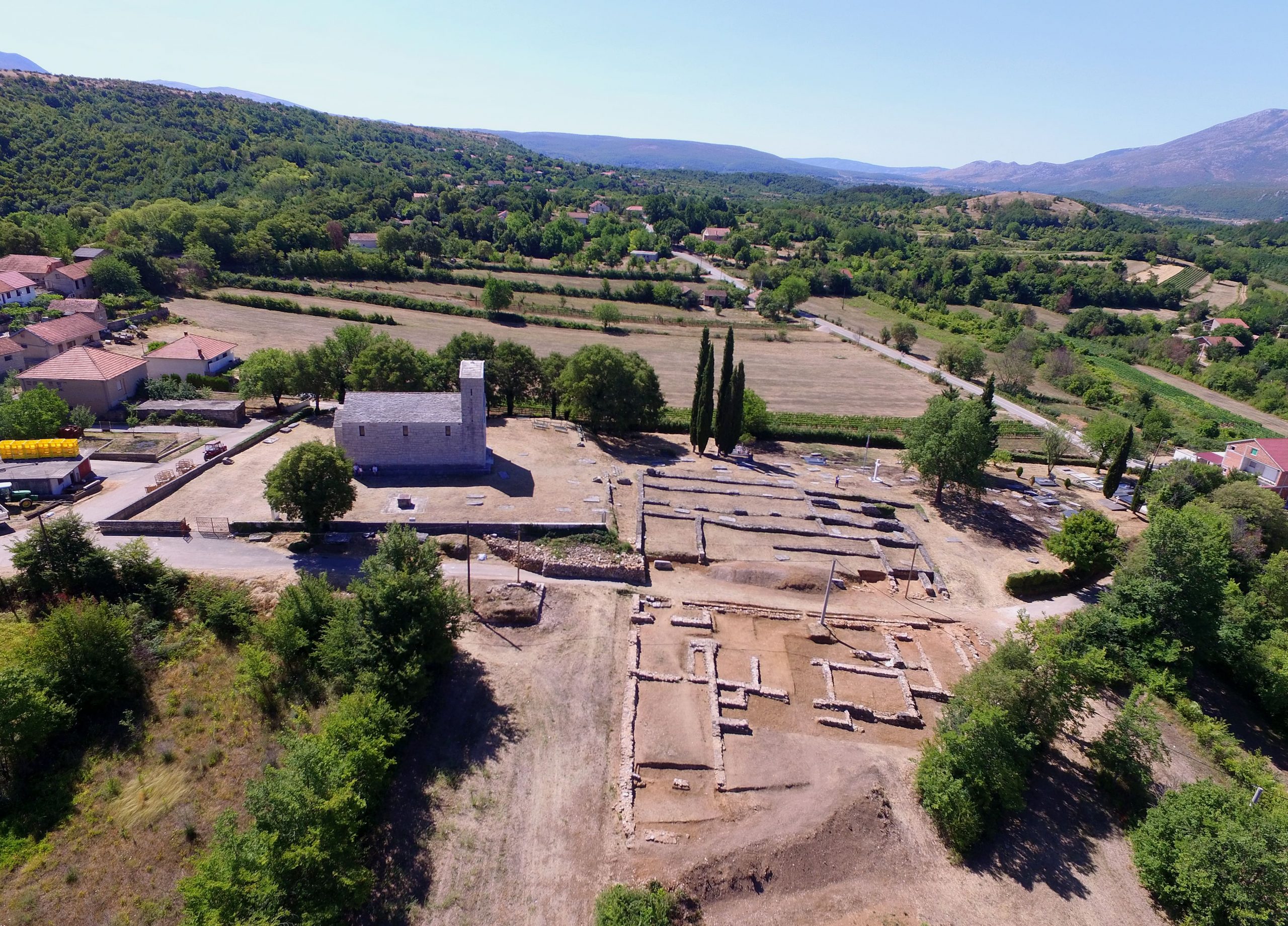
The village Biskupija is located about five kilometres southeast of town Knin. Judging by the number of excavated ruler churches, the area of modern Biskupija was one of the centres of the early medieval Croatian state. The largest and most significant among the ruler churches was the church of Saint Mary at the site Crkvina. Prior to the construction of the church, during the 8th and early 9th century, it was the location of a cemetery with rich burials of warriors-horsemen with Carolingian equipment. Successively, the basilica dedicated to Saint Mary was built in the first half of the 9th century. The church had three naves, with masoned rectangular columns and three rectangular inscribed apses. A three-part anteroom (the so-called westwerk) with a bell tower was added on the west side. In the 11th century, Saint Mary became a cathedral, i.e. the seat of the Croatian bishop, with the first known bishop being named Marko. A large number of relief-decorated stone fragments found during archaeological excavations of Crkvina shows that the liturgical stone furniture has been changed several times; here the altar rail with the image of the Virgin and the ciborium (baldachin above the altar), exhibited at the Museum of Croatian Archaeological Monuments in Split, stand out as exceptionally significant examples of pre-Romanesque sculpture. The three-nave basilica was probably burned down at the end of the 12th or during the 13th century. Soon afterwards, above the former basilica, a small single-nave church of the same saint titular was built, which today can be recognized only in the foundation walls placed between the columns of the older basilica. Today, the Church of Our Lady, built in 1938 according to the design of Ivan Meštrović, is located immediately beside the site.

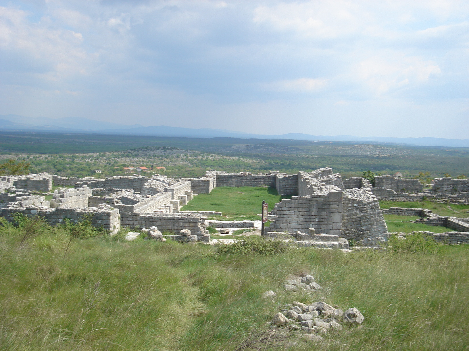
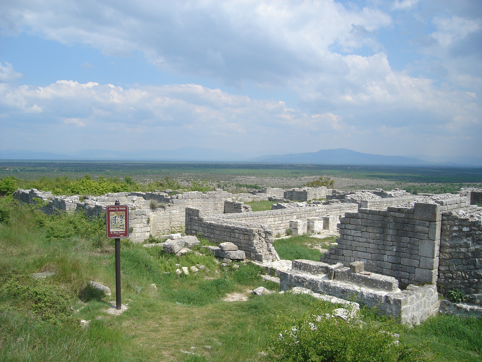
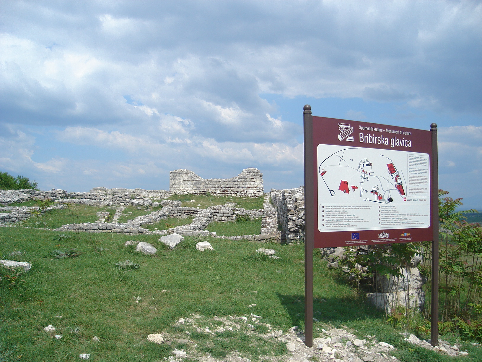
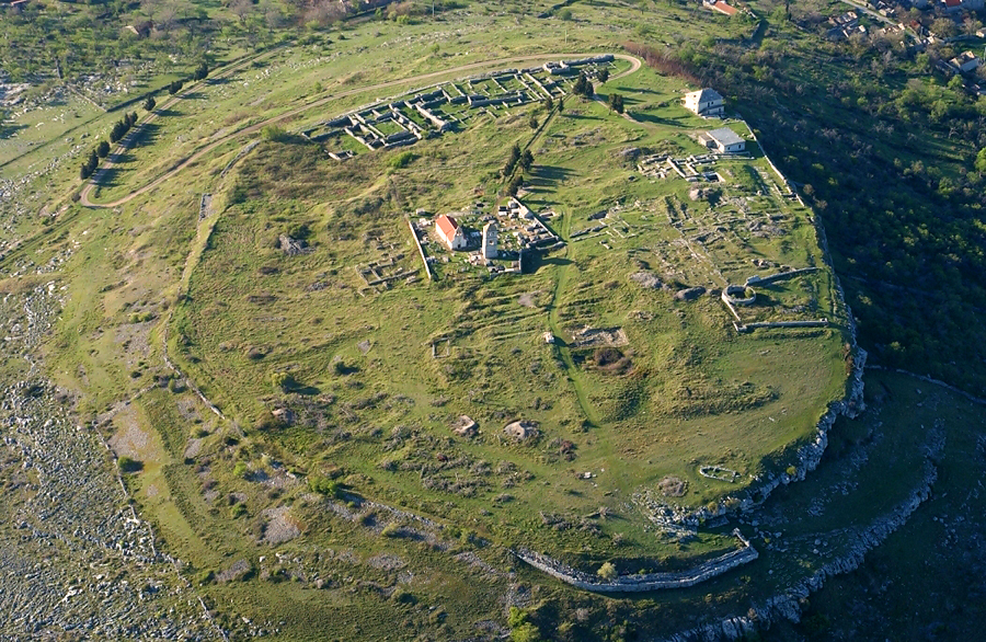
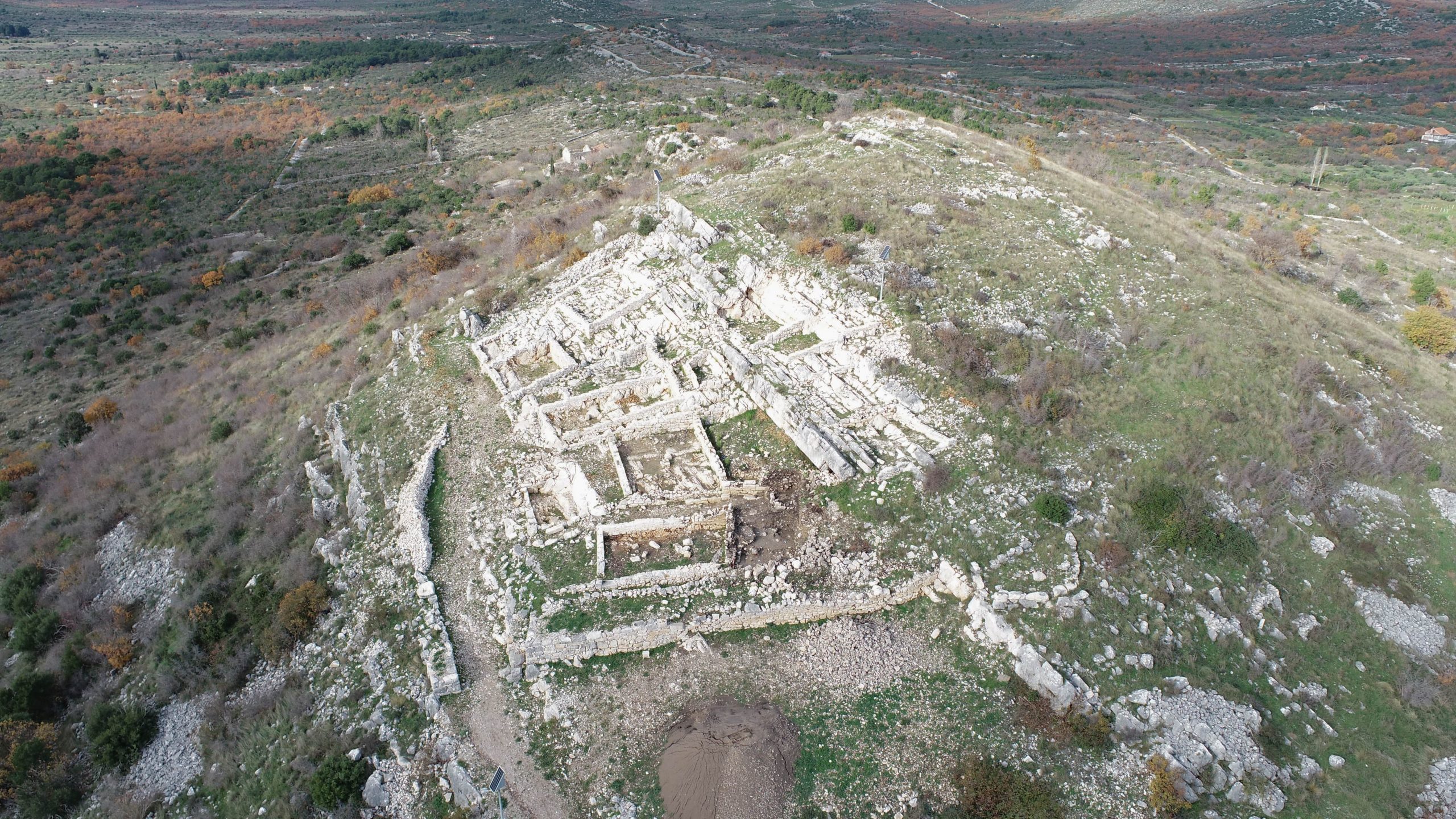
Name of archaeological site: BRIBIRSKA GLAVICA (Bribir)
Type of archaeological site: settlement
Location: near by City of Skradin
Bribirska Glavica is one of the most important archaeological sites in Croatia, with over 2500 years of the settlement continuity. The excavations began in 1910 and, up to date, one third of the settlement area has been revealed (total area within the defensive walls is about 72.000 m2). In addition to the architectural remains from the various historical periods presented in situ, a museum collection was also open at the site. Bribirska Glavica began its life in the 1st millennium BC (in the Iron Age) as a fortified settlement of the Liburnian tribe Varvarinae. At the turn of the era, the settlement named Varvaria evolves into a Roman town. In the 1st century, a massive defensive wall was built, which is today best seen on the eastern side, along the access road. In the Middle Ages, however, the town was known under the name Brebera, and was particularly significant in the 12th and the 13th century as the seat of the powerful dynasty of Šubić. Among the members of the Šubić family, Paul I had risen the most on the political scene. He was honoured Ban of Croatia by the king of Hungary, and was later also awarded with the title Lord of Bosnia. The presented remains of the Gothic church of Saint Mary and the Franciscan monastery, that were destroyed in the Ottoman attacks in the 16th century, are dating from that period. At that time, due to the intense war conflicts between Venice and Ottomans, life on Glavica ceases, and a new village modern Bribir is soon to be formed.


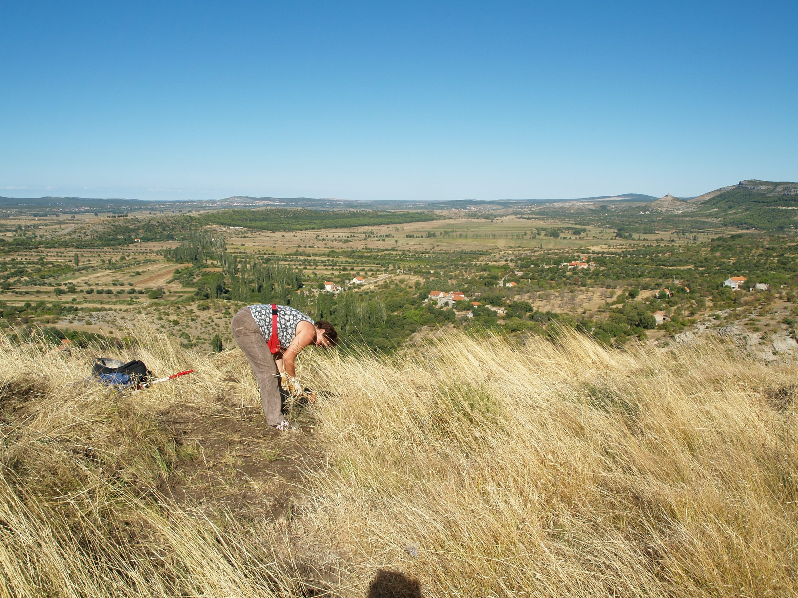
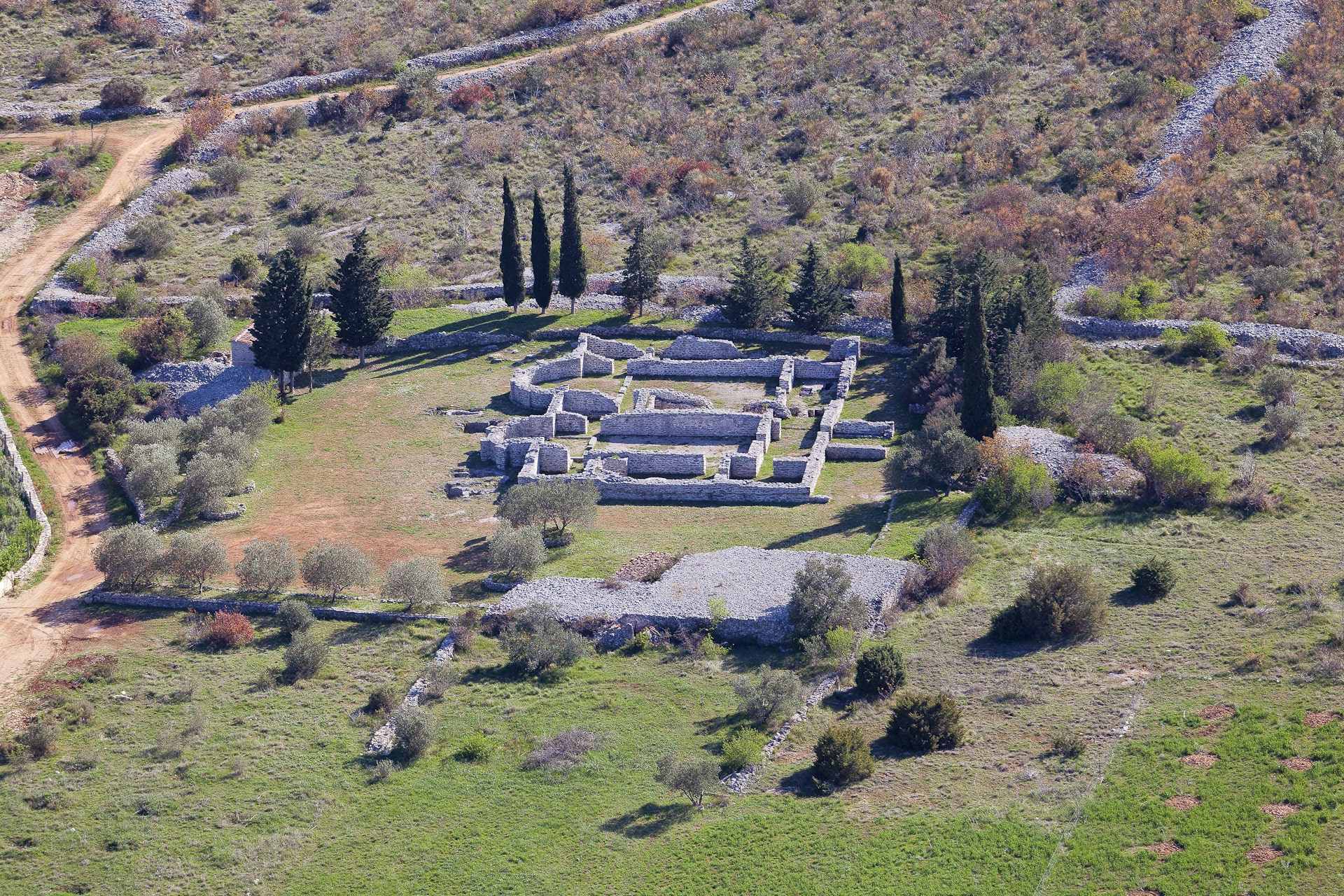
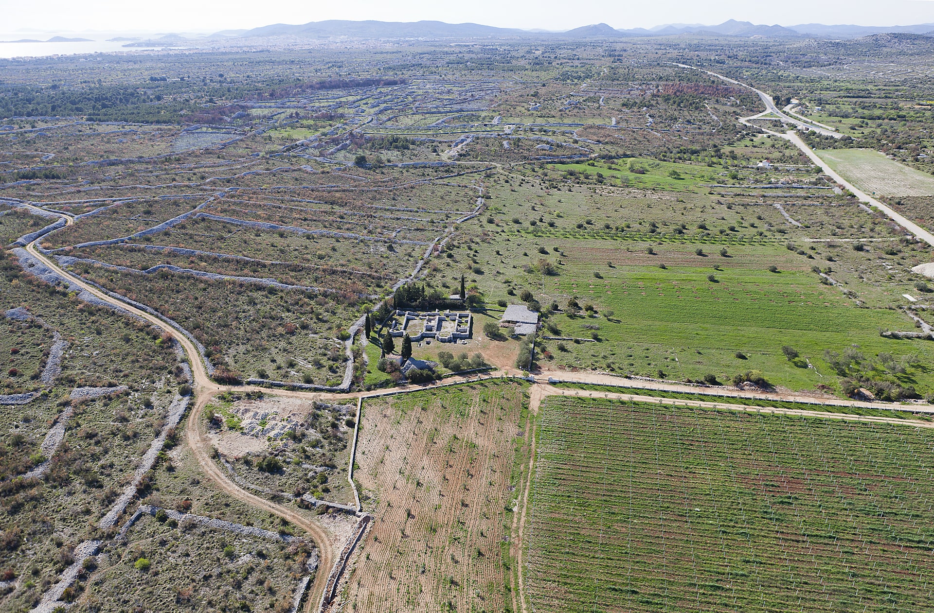
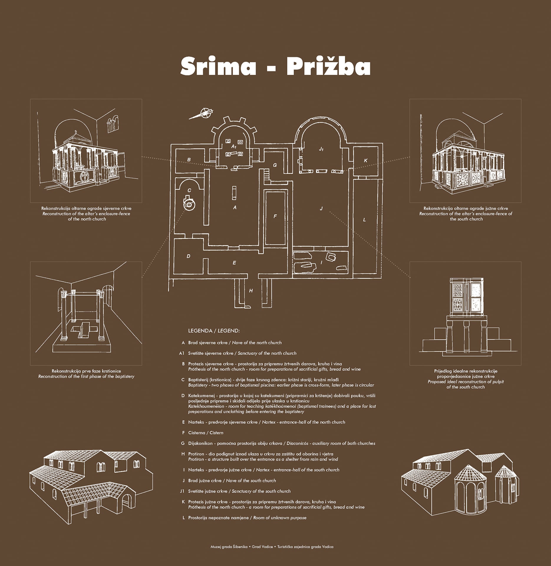
Name of archaeological site: PRIŽBA (Srima)
Type of archaeological site: twin church
Location: near by City of Šibenik
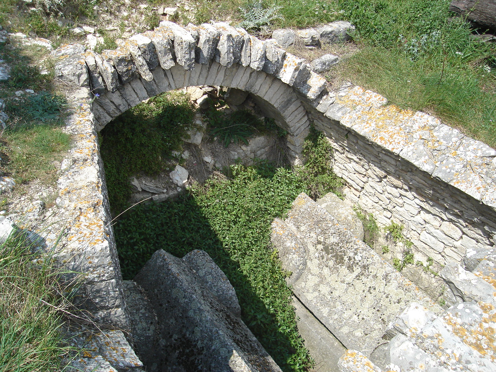
In a valley in the hinterland of the village Srima, an Early Christian twin church complex, belonging to the type of sacral architecture called basilicae geminae (“twin churches”) was discovered and explored during the eighties of the last century. They are two connected single-nave churches, where the northern church was built first, and the southern one was then annexed. In both churches the sanctuary area (presbytery) was located within the semicircular apse, and from the rest of the church it was separated by a stone altar fence whose base is visible in the floor. The altar fences were decorated with characteristic Early Christian relief ornaments. The northern part of the complex houses a baptistery that was first executed in the floor in form of a cross-shaped indentation with an access staircase, to finally reach the shape of a circle. The twin churches in Srima were built during the 6th century, and the stone furniture was modified for the last time in the 7th century.

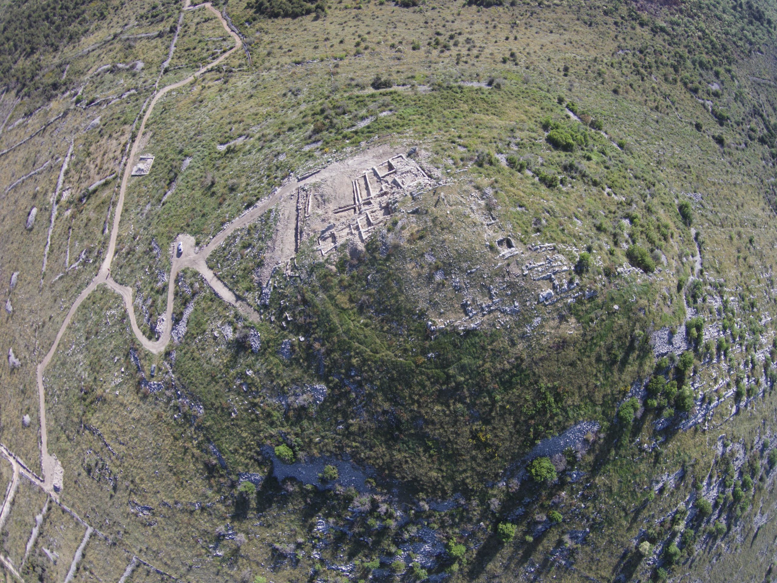
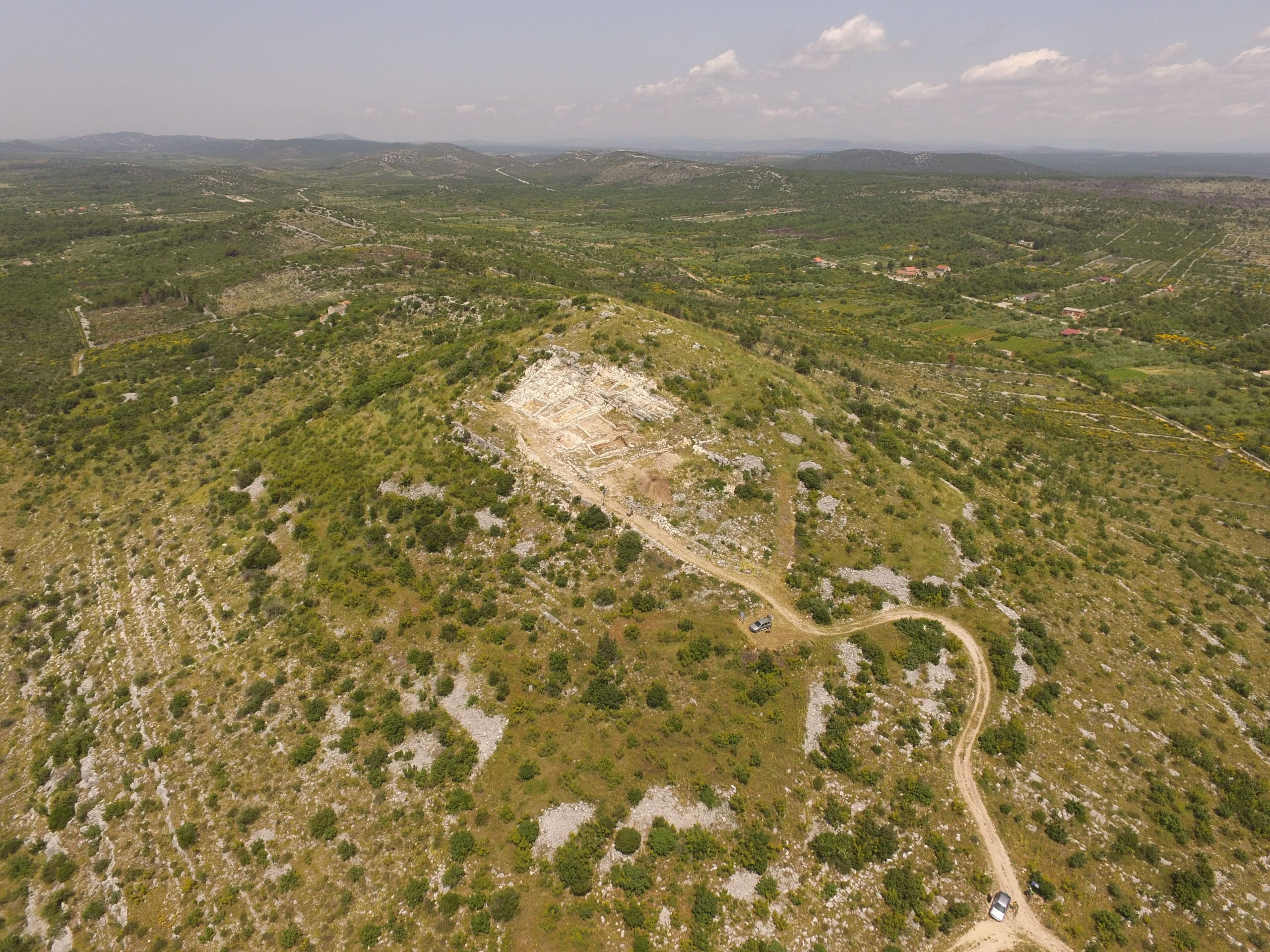
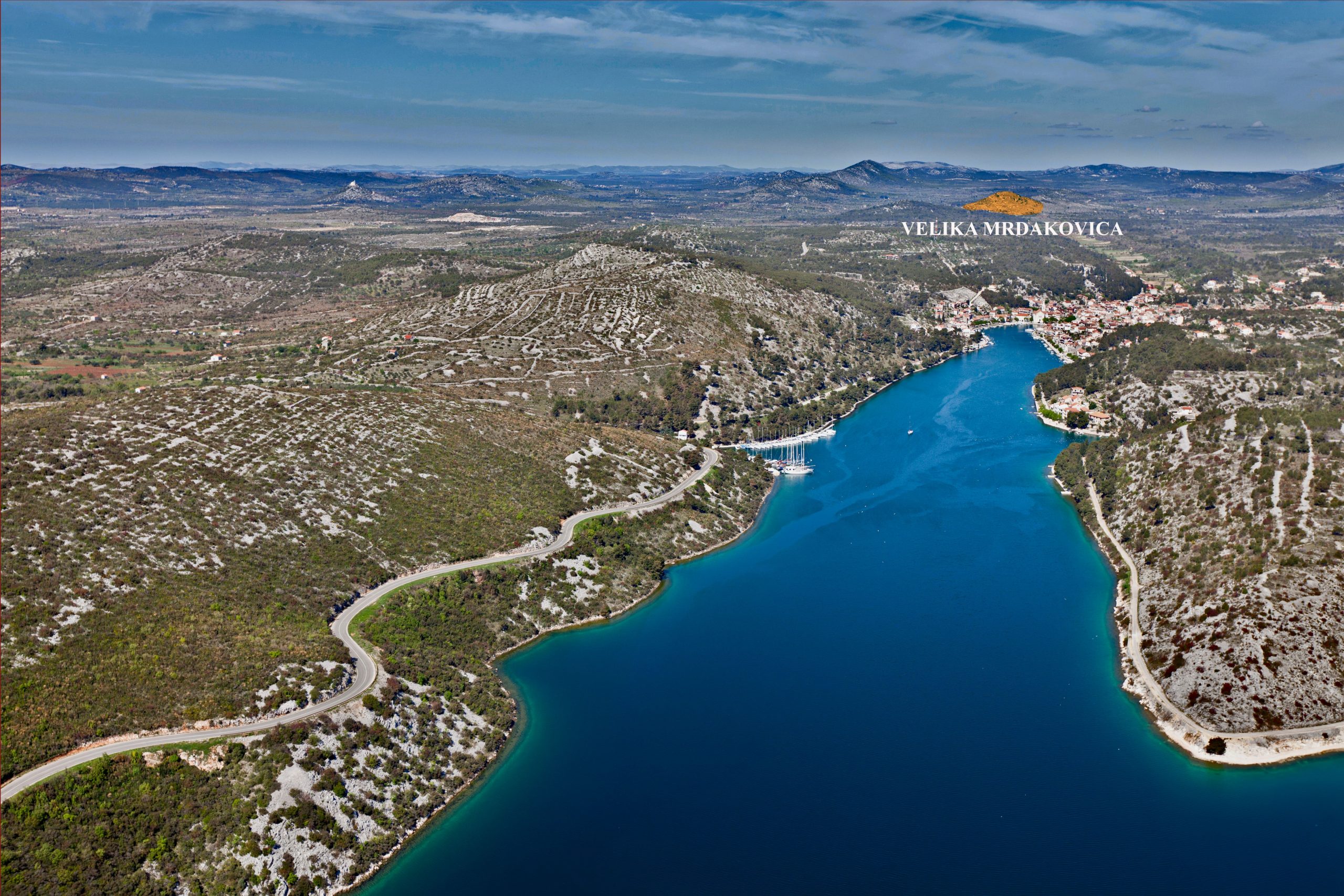
Name of archaeological site: VELIKA MRDAKOVICA
Type of archaeological site: settlement
Location: near by City of Vodice
The archaeological site Velika Mrdakovica is located in the hinterland of the town Vodice. At the top of the eponymous hill with a great view on Adriatic islands, Dinara and Velebit mountain chain a settlement was inhabited around 1000 years (7th century BC – end of the 1th century AD). Latest excavations at Velika Mrdakovica has began in 2011. and it last till today. It was a very prosperous Liburnian and Roman city (Arausona). At necropolis and settlement we have find many luxurious and rare items from prehistory to Roman times. New archaeological excavations wich took a place in 2014 during a EU project „Preparatory and archaeological works on the archaeological site Velika Mrdakovica / Pripremni i arheološki radovi na lokalitetu Velika Mrdakovica“, HERA-FB2-W-02/14, revealed about 1500 m2 of settlement area, with a series of rooms streets and passages.The excavated part of the settlement (around 20 percent of total area) is located right next to the main city entrance, and a segment of the monumental city walls is also defined. This archaeological site is highly visible and very interested tourist destination.


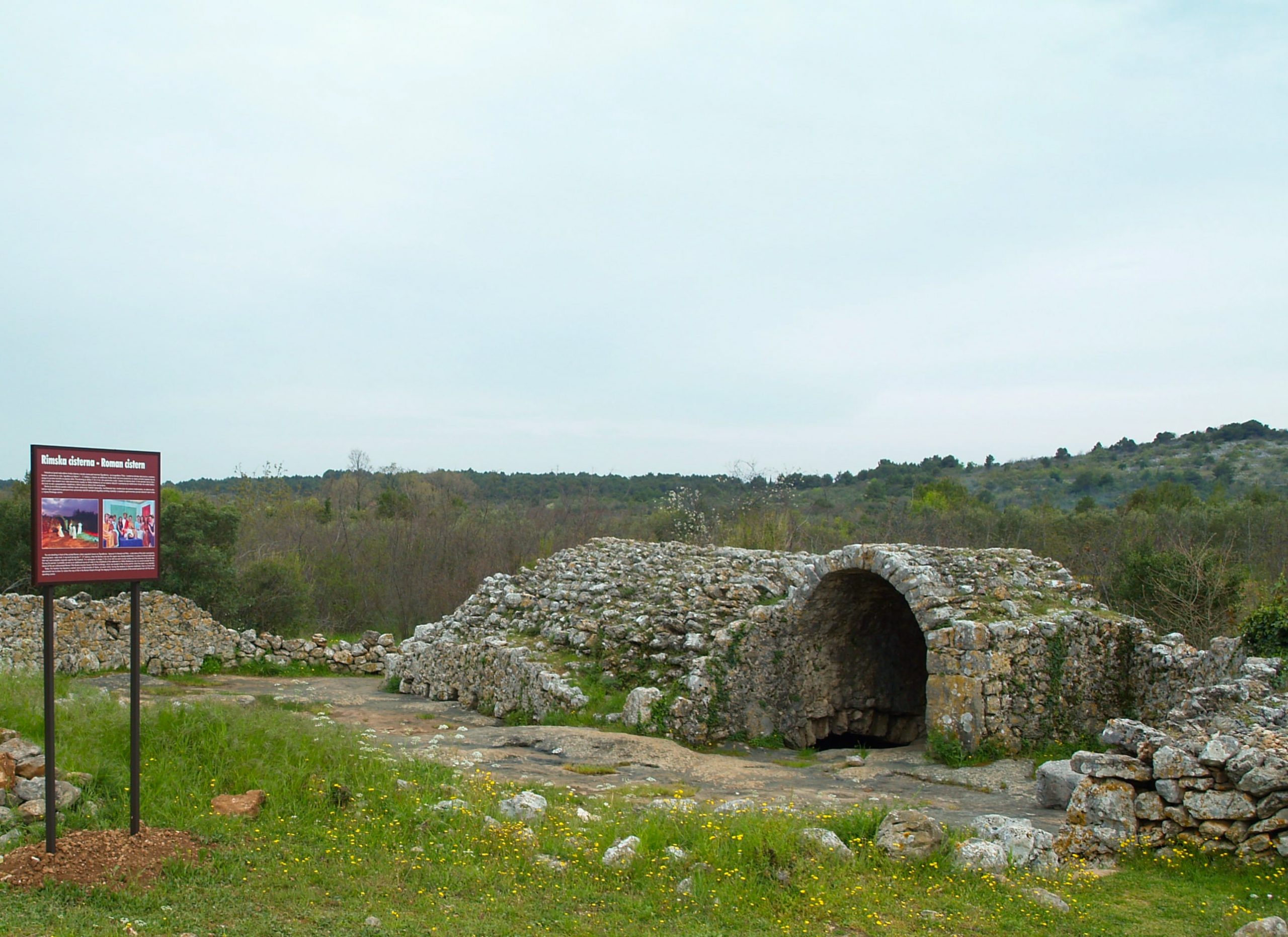
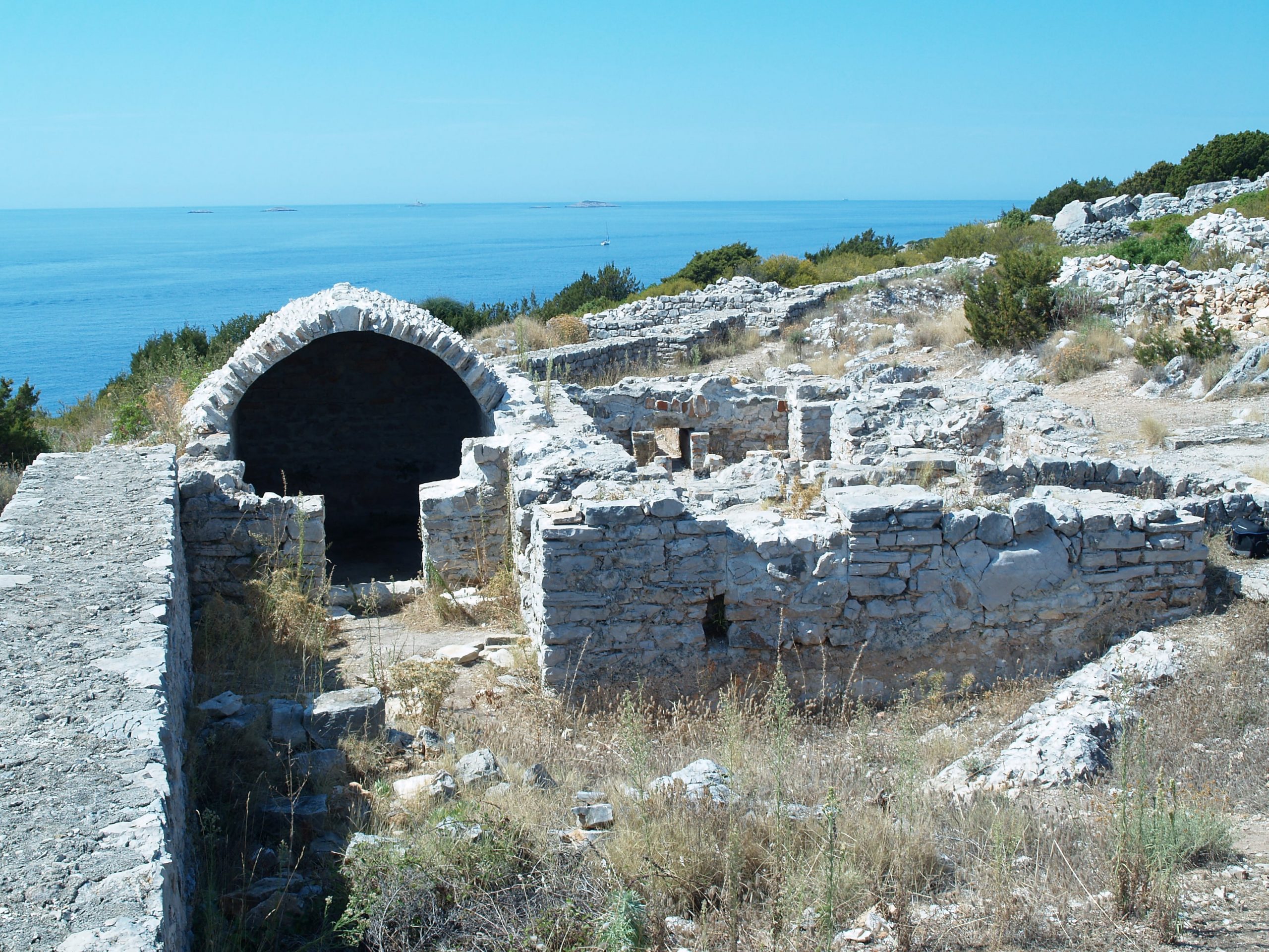
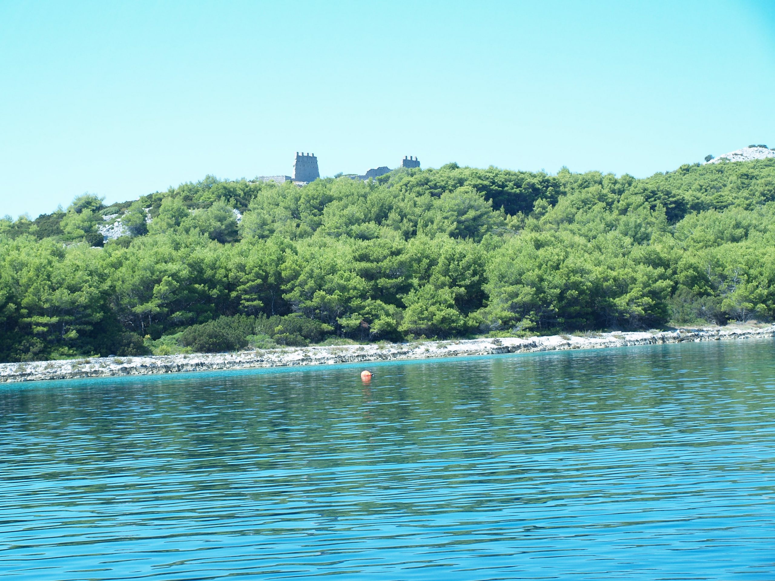
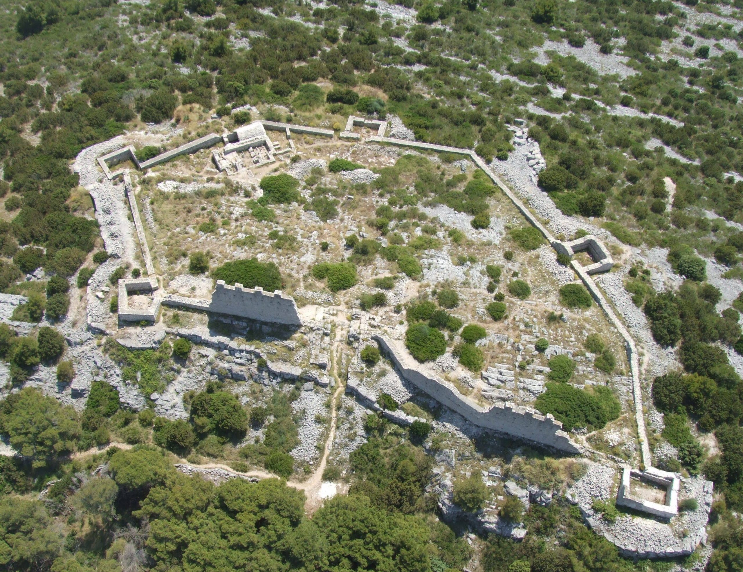
Name of archaeological site: GRADINA – JUSTINIJANOVA UTVRDA
Type of archaeological site: fort
Location: island Žirje
Žirje is the farthest island of the Šibenik archipelago and therefore countless merchant ships have passed along its rocky shores from the very beginning of Adriatic sailing routes. Žirje has therefore provided a way to control the navigation routes in the past, but also offered anchorage for tired sailors. In the 6th century, emperor Justinian I, ruler of the Eastern Roman Empire (Byzantine Empire), ordered the construction of two fortresses in the southern part of Žirje. The fortresses are today popularly called Gradina and Gustirna. They formed a part of Justinian’s so-called Limes maritimus, which consisted of a whole series of fortresses on the Adriatic islands and in the coastal area. The function of the Limes was to control and defend the navigational routes in times immediately after the emperor had partially executed his intention to conquer the former area of the Western Roman Empire. The fort Gradina is one of the best preserved and among the rare fully excavated Justinian fortresses. It has a surface area of about 3000 m2 and is surrounded by a double rampart. The inner rampart was topped by a crown and reinforced with five towers. The exterior rampart was a few meters lower, but it was built of far larger blocks. Archaeological excavations at the interior side of the southern segment of the rampart revealed a room complex assumed to be the commanding officer’s apartment. The fort was short lived and probably abandoned shortly after Justinian’s death.


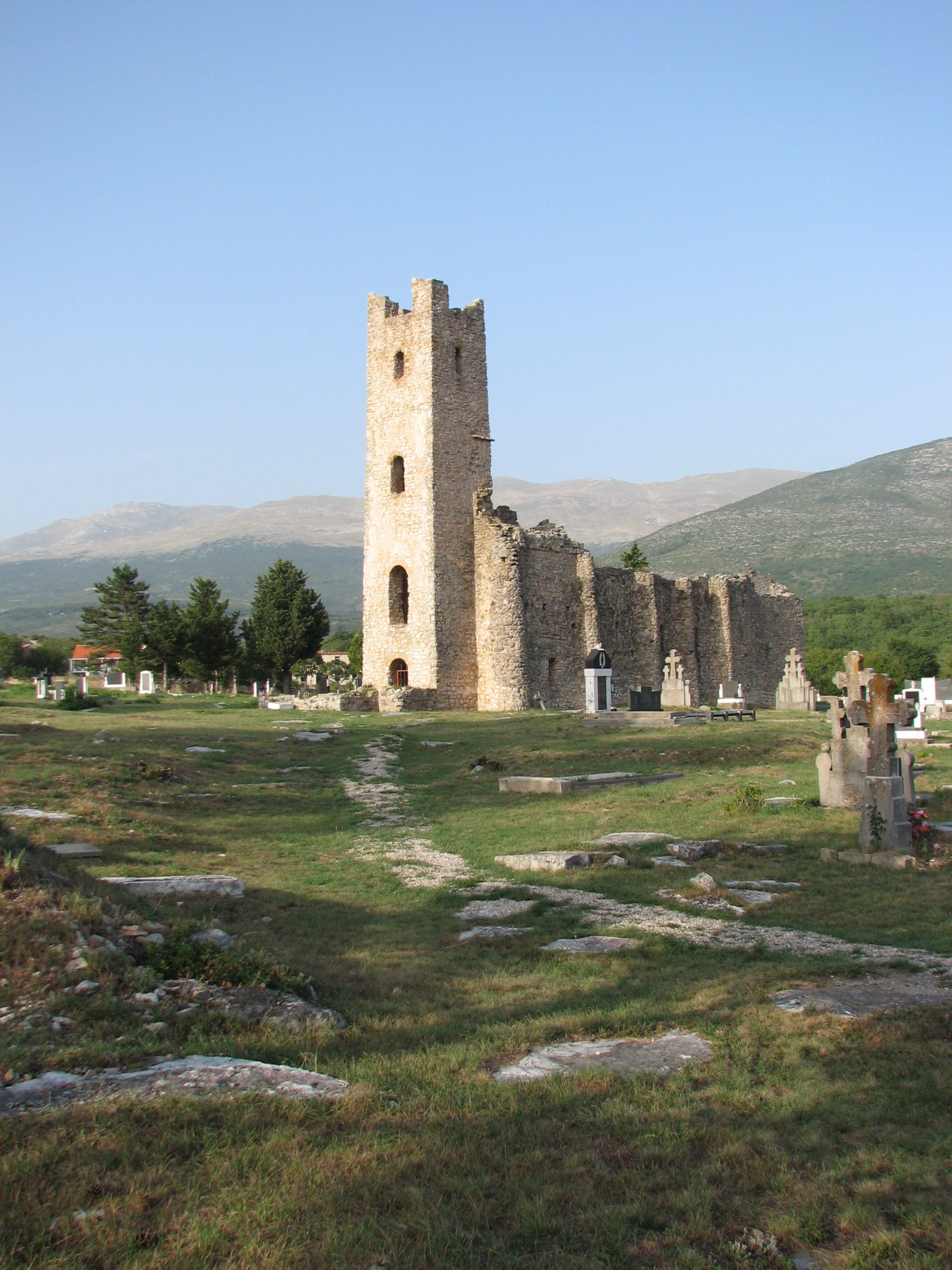
Name of archaeological site: SVETI SPAS
Type of archaeological site: twin church
Location: near by City of Knin
During the Middle Ages, the village Vrh Rika was located in the area of the modern village Cetina, near the picturesque spring of the eponymous river. Due to the raids of the Ottomans, the village was abandoned, and its inhabitants transferred the name of the old settlement to their new home ̶ modern town Vrlika. However, one enormously valuable trace of the old village is still preserved: Church of Holy Salvation (Sveti Spas) from the 9th century. Holy Salvation is the best-preserved building of the pre-Romanesque period in Croatia. Judging by the inscription from the stone altar fence, the church was a private endowment of the prefect Gastika and was originally dedicated to Jesus Christ. It is a single-nave structure with a shrine in form of three semi-circular apses in the east. Due to the restauration works in the 14th century, the central semi-circular apse was removed and replaced with a square-shaped Gothic apse that can be seen today. The inner and outer sides of the walls have reinforcements in form of square lesenes and rounded buttresses that are narrowing towards the top. On the west side of the church is the oldest preserved bell tower in Croatia, followed by the anteroom of the church (westwerk) that has two floors. On the upper floor, there is a room with arch openings facing the shrine, through which prelates followed the liturgy from a sort of a gallery. This floor was accessed by an external staircase through a door on the first floor of the bell tower. The walls of the bell tower on each floor have simple arched windows, and a partially preserved mullion on top. Around the Church of Holy Salvation, there is a medieval cemetery with a long continuation of burials, from the 10th to the 16th century.

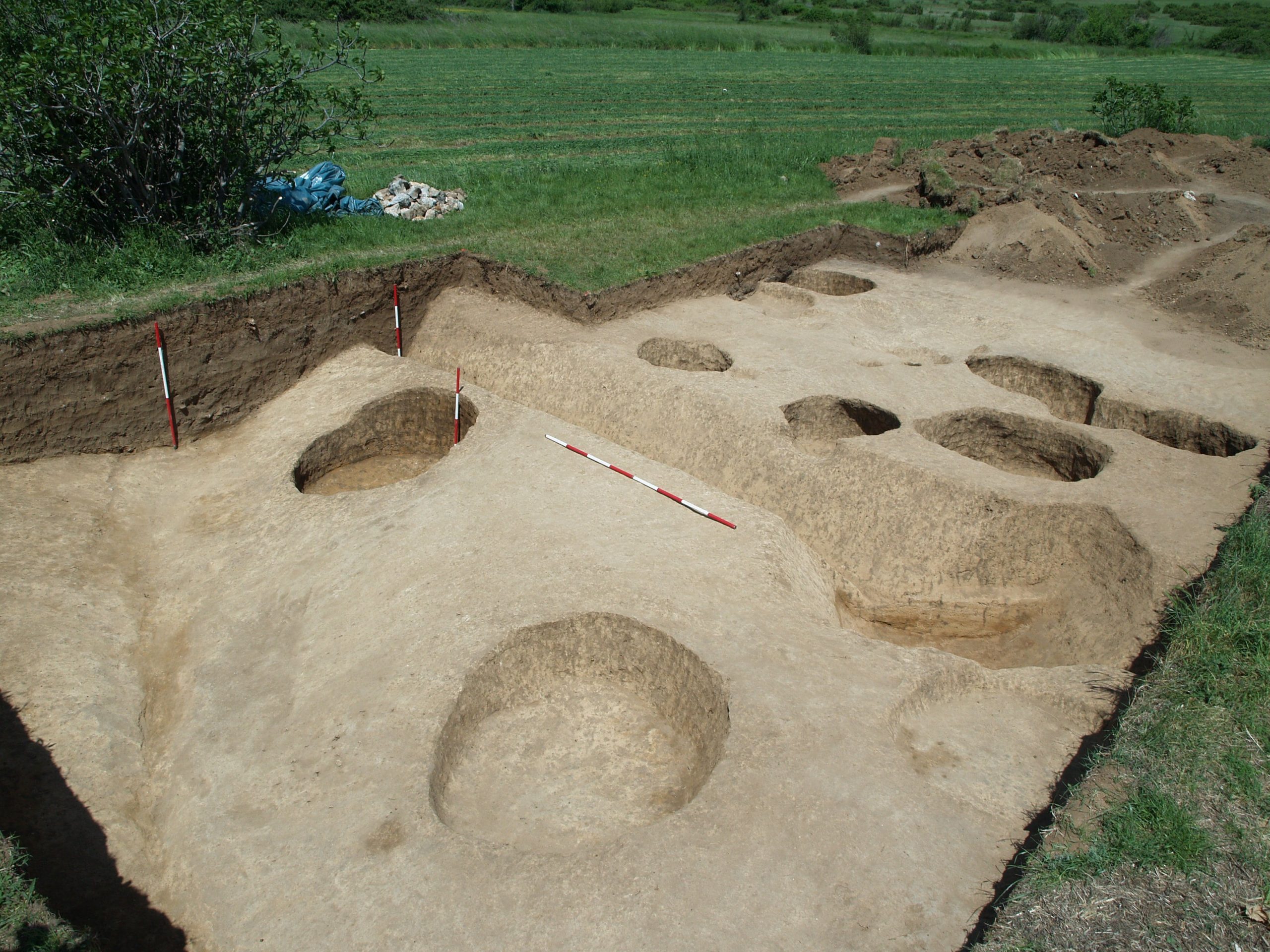
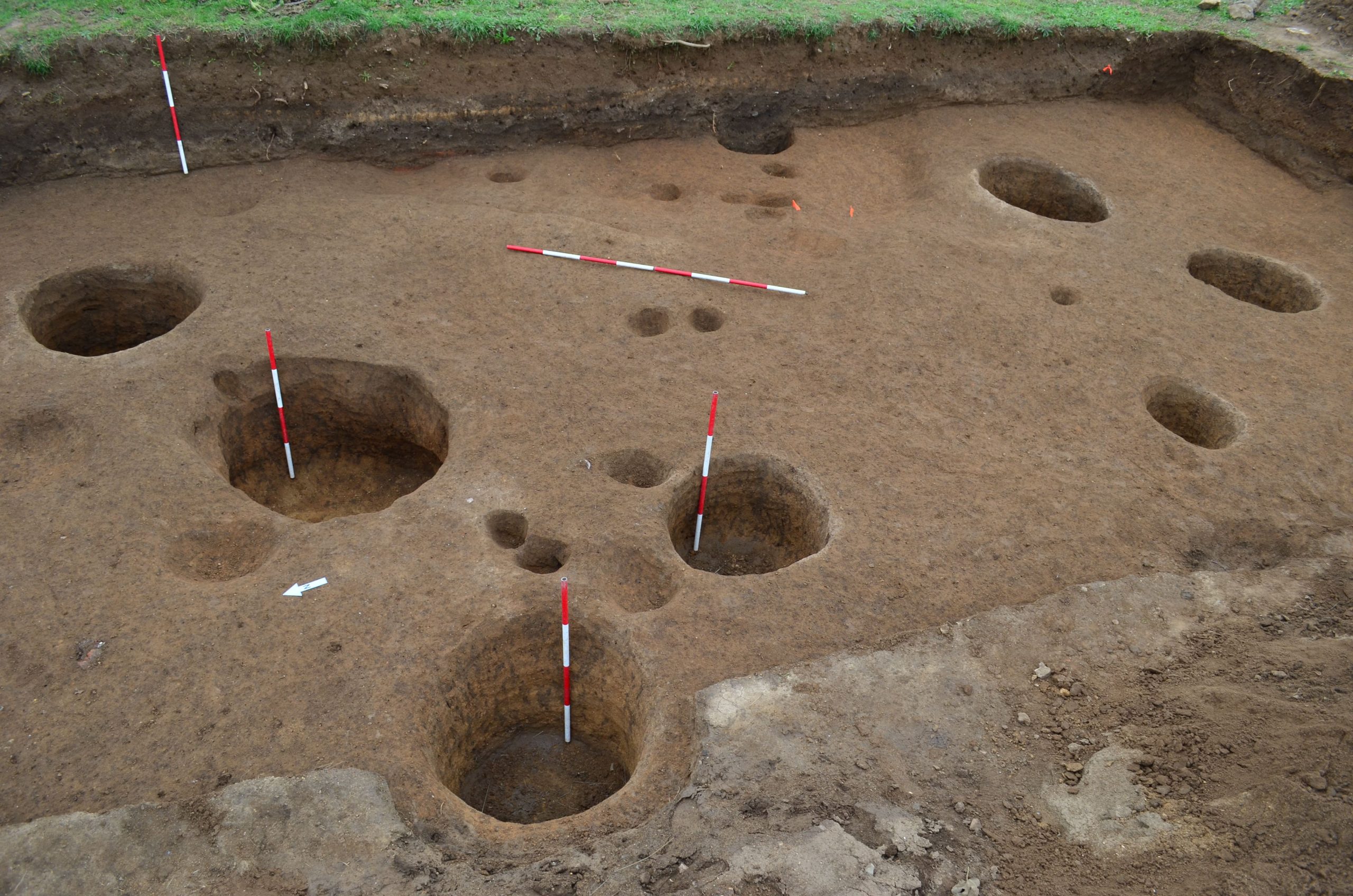
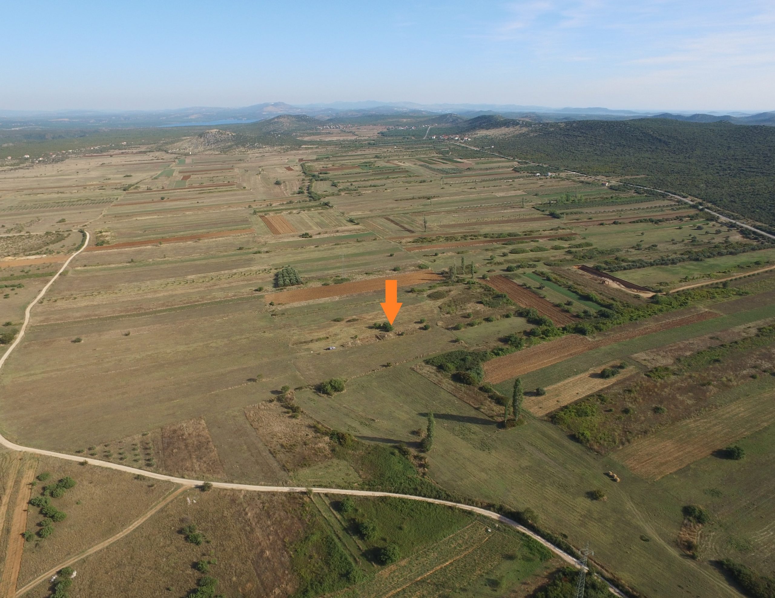
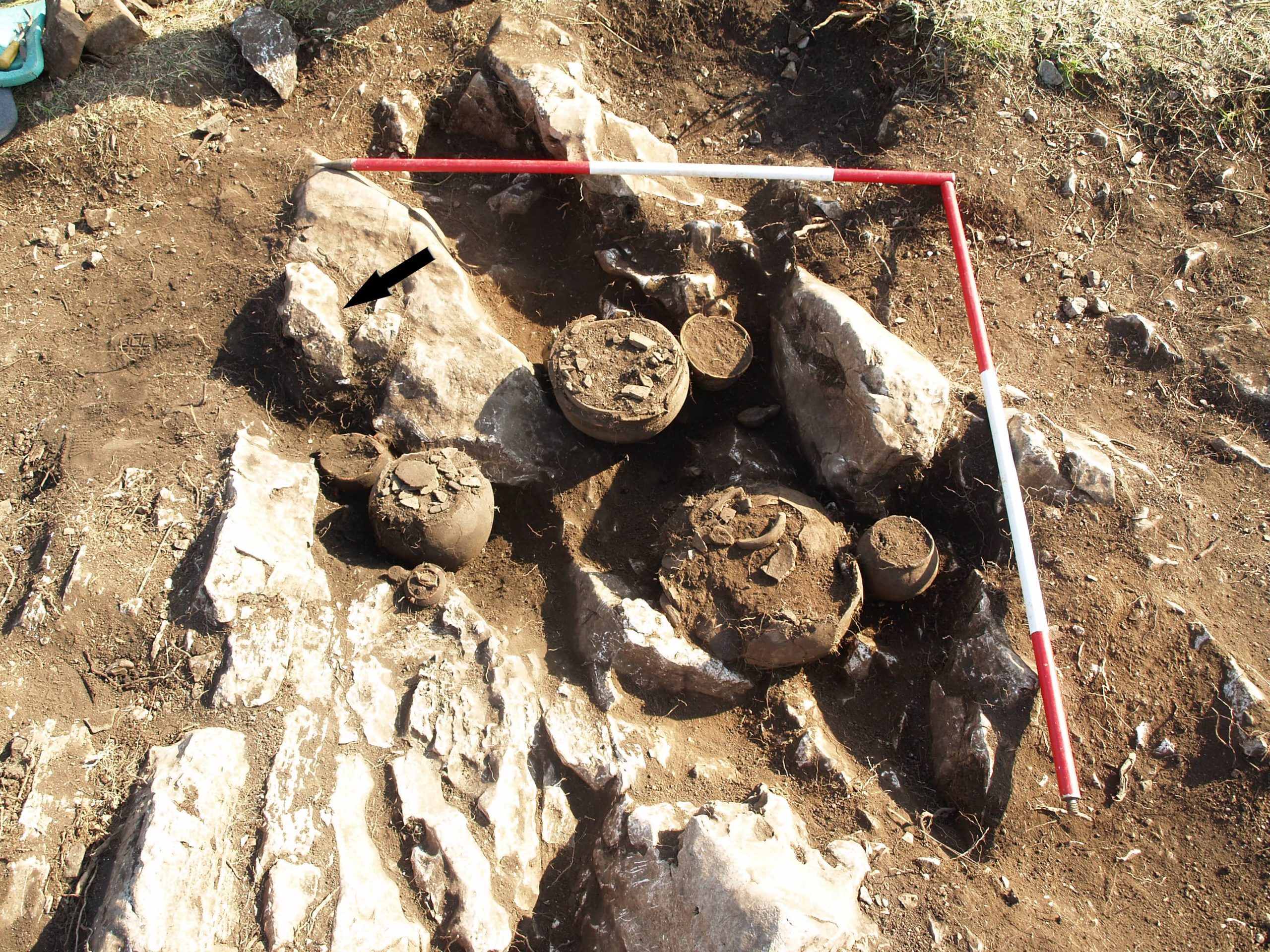
Name of archaeological site: VELIŠTAK (Čista Mala)
Type of archaeological site: neolithic settlement
Location: Velimsko polje
In the Velim’s field, at the Velištak archeological site, there are the remains of a settlement from the late (so-called Hvar) Neolithic phase, which marks the 5th millennium BC. Systematic archaeological excavations and radiocarbon dates show that this site was inhabited during the first few centuries of the Hvar phase: the settlement was founded shortly after 5000 and lasted until 4700 BC at the latest. Among the remains of the settlement, buried objects are the most numerous. These are mostly regular pits with round or oval floor plans that are usually interpreted as food storage. The above-ground buildings have been preserved more modestly, mostly in the form of segments of paved clay floors or foundation trenches into which the wooden wall construction of the house was driven. In addition, a part of the settlement with a larger open area densely covered with stones was explored, which served as a stabilization of the terrain near the former stream. In ongoing research, Velištak proves to be a typical representative of the Neolithic village in northern Dalmatia, which has functioned in one position for several generations, and is the first open-air settlement from the Hvar phase in Dalmatia (also its earliest known site). .